April Fools Day and we are off to Milford Sound – weather looking a bit dodgy unfortunately. Bus picked us up at the Alpine Cafe across the road from the Club Park. The tour started in Queenstown and we were the last ones aboard. A full bus (a good mix of Germans, Australians, Asians and Kiwis).
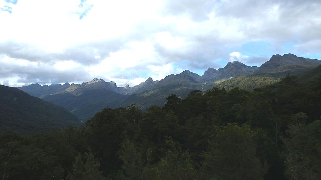
Left Te Anau and headed through the Eglington Valley. The driver made stops at places of interest and kept up a running commentary about all sorts of things – history, vegetation, swedes (the eating kind), farming, conservation, scenery, named mountains, road building, huts and tracks, deer and rabbit hunting and so on….. First stop was at at a lookout along the Eglington Valley.
Eglington Valley – Milford RoadRoad Lookout
Then Mirror Lakes for a short boardwalk – pretty crowded as other tour buses offloaded their passengers at the same time.
Mirror Lakes
View from Mirror Lake
A little further on is Knobs Flat where there is a substantial loo block and Visitor Interpretative Display about the Milford Road. There is also a private Camping Ground here and a little further on a small DOC camp.
The bus then turned into a viewpoint with some impressive mountain views.
Fiordland viewOur ‘transport’ at viewpoint
Arrived at the Homer Tunnel and had to wait at the RED light for traffic coming out from Milford. Tunnel was just as we remembered it on our previous trip through many moons ago.
Stopped again just after the zigzag on the other side to take in the views and check out the “best water in NZ” from the stream.
Discussing the taste of the best water in NZCarpark after the Homer TunnelBig valley – little glaciers on the mountain topsGlacier viewView on the other side of the Homer Tunnel
Arrived in Milford and the bus parked at the Ferry/Cruise Terminal and we received our boarding passes for the cruise on the Juicy boat. Boarded shortly afterwards and we left promptly at 1130 for our 2 hour cruise. Clouds were really starting to set in by this stage, Mitre Peak still completely visible but looking impressively dark and brooding.
Passed by the Bowen Falls then followed the southern side of the Fiord out to the Tasman Sea.
Lots of trickling waterfalls and other cruise boats doing the same circuit.
Real Discoveries cruiser
We didn’t venture far out into the open sea before we U-turned to cruise back along the other side of the towering walls and passing close to ‘seal rock’ where a few seals were resting.
Seal RockThe one on the left looks like its trying to ‘fly’Stirling Falls
By this time the low cloud had turned into light rain so it was not very pleasant on the top deck and most people were sitting inside and seemed to have lost interest in the views as a consequence. Some were reading, snoozing and even playing cards – I couldn’t see that was giving them their ‘moneysworth’ for the cost of the cruise.
But it was nice standing on the covered open deck at the back and I even spotted a pod of dolphins leaping over the wake of the boat but they were gone in an instant and too quick to catch a photo.
We had closer views of the trickling waterfalls and the boat did the usual ‘party trick’ of nosing into the waters of the Stirling Falls so a few brave souls could stand at the bow and get soaked in the spray.
We lunched on board – included in the price of the tour was a voucher for a large sized chicken or beef wrap and cups of tea were provided. If you wanted coffee that was extra.
Raining on the way backPanorama view
All too soon we were back at the wharf where the terminal was jam-packed with people all waiting to get onto the next round of cruises – we had to practically fight our way through them to get back to the bus.
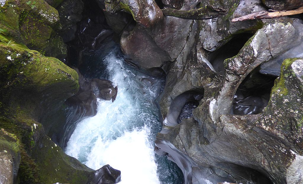
We made a few stops on the way back to Te Anau. First one was before the Milford Tunnel to The Chasm. A 15 min bush walk to view a torrent of water tumbling through rock cracks carved and worn smooth by the force of the water over the years. It was quite impressive.
Bushwalk on way to The ChasmSmooth sculptured rocksDown the ‘hatch’Is it a Pig stuck on the rock? OK its just a log!
Queueing to return for the return through the Homer TunnelAnd back on the other side again
After the tunnel we stopped on the side of the road for a quick look at Falls Creek – lovely blue water.
Falls Creek – amazing blue water
Then called in to the picnic area at the north end of Lake Gunn.
Lake GunnBush around Lake Gunn picnic areaThe ‘boys’ skimming stones
Made a couple of more stops to check out views and arrived back at Te Anau around 1600. We were dropped off at ‘our gate’ on arrival.
Looking towards South Arm of Lake Te Anau
It was a good trip and we both enjoyed it – the weather could have been better but it was interesting to see Milford in a different mood.
* * * * * * *
The next morning saw us heading back up the Milford Road (under our own steam) to visit a couple of places that the tour bus didn’t go to. There are several DOC camps along the road so no shortage of places to camp up. Spent the first night at the closest one to Te Anau (Henry Creek) which was pretty crowded with people as well as sandflies.
Looked in at Te Anau Downs where the water transport leaves to drop people up the North Arm of the lake to the start of the Milford Track. Walked along the jetty – the lake was eerily calm in the early morning.
Wharf at Te Anau Downs & Milford Track Barge
From there the roadway leaves the lake and heads up the Eglington Valley.
Amazing clouds at Eglington Valley
We got as far as the Totara DOC camp and it was so nice there we decided to stop for the rest of the day. The Eglington River was running alongside us and tall mountainous hills across the valley.
Eglington RiverMirror Lake and resident duck
It rained overnight but it had all cleared up by mid-morning so we moved on, stopping again at the Mirror Lakes to take a few more photos as it was a better viewing day than when we called in on the bus trip.
Reflections – Mirror LakePanorama of Mirror Lake
Heritage Area InformationRugged hills behind Mirror LakeHumboldt Falls
Some of the DOC camps further along were very small areas and one was closed due to the danger of tree falls. The last one at Cascade Creek is the largest camp and the busiest, being the last one before the Homer Tunnel. We decided we’d spend the night there, but as it was still early in the day we continued on to do some more exploring.
We turned right to drive along the Hollyford Road to go and see the Humboldt Falls at the road end. Asteepish 30min returnwalk to view the falls which drops 200 metres in a three tier cascade.We were not disappointed when we got to the viewpoint. There was plenty of water in the falls and we got a bonus view as the last two days of rain had also created two more cascades, one on each side of the main drop. Comments from other people have said that the falls were not much to see when they’d visited. Rain sure does work ‘magic’ in the Milford area.
Three cascades after the rainStart of the Hollyford Track
The Hollyford Track starts at the end of the road over a swingbridge and there is a boat ramp here too, so presumably they motor down the river to Lake McKerrow.
Hollyford SwingbridgeHollyford River
On the way back there was another swingbridge over a rocky part of the river with fierce rapids and a rough very wet track led off over the other side to Moraine Creek.
Hollyford River upstream from The Moraines swingbridgeDownstream from swingbridgeJust another swingbridge
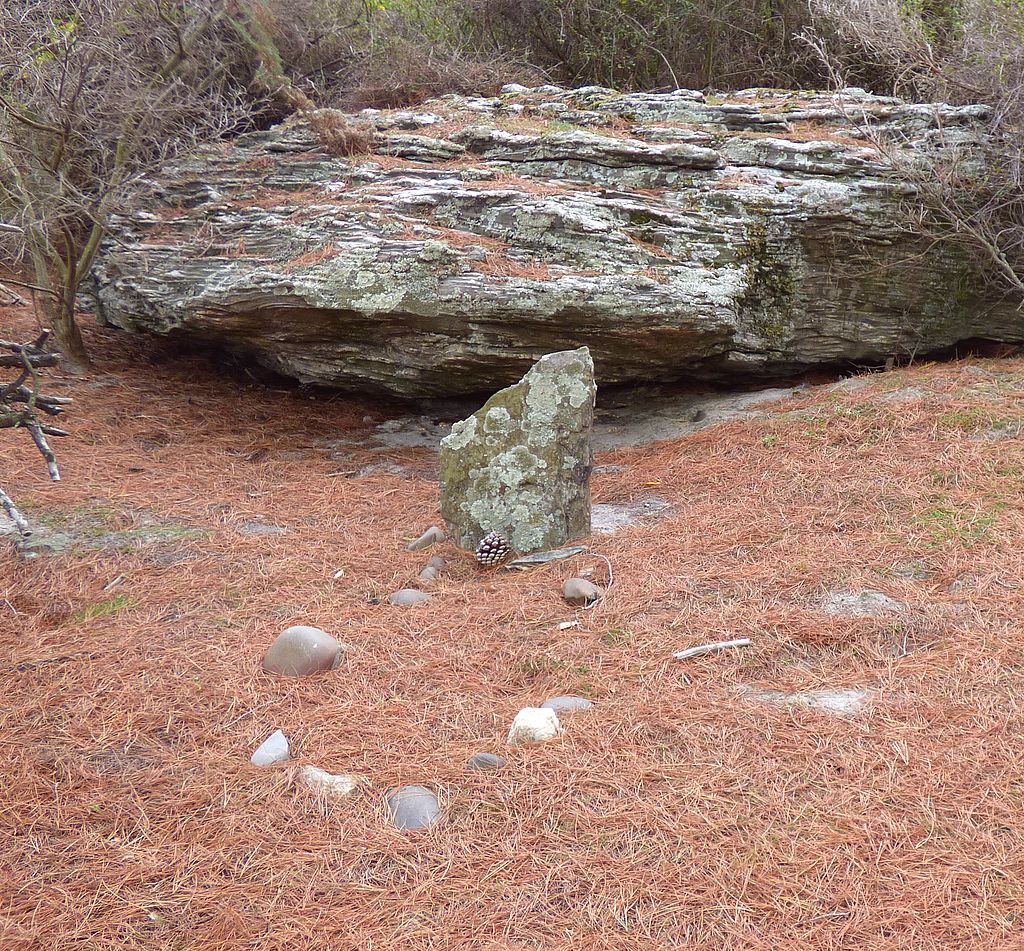
Further on we also checked out a signpost pointing to an historic grave which we found right on the riverbank after a short walk through the trees. Apparently he’d set off with the area Postman to deliver mail to Martins Bay but the pair got caught in bad weather and circumstances. After several days of struggling Donald became ill with hypothermia and exhaustion so the Postie carried him back down into the valley. 16 days after they set off, they arrived back at this spot where they were finally discovered by a Search Party. The Postie was taken to Queenstown and recovered but Donald was too ill to be moved far and died a week or so later and was buried at this spot. Tough days!!
Lonely Grave site on the riverbank
We also made a stop at Gunns Camp and I wandered around and ‘cheekily’ took a few photos of some of the ‘quirky’ things there. This is a ‘pay’ campsite run by a charitable trust but it’s of historic significance for the Gunn family who pioneered tourism in this area.
Davey Gunn bought it in 1952 and after him his son, Murray Gunn, ran it for 51 years. He was the one with the sense of humour – on the signpost the top arrow points to ‘heaven’ and the bottom one points to his own monument ‘Gunns Rest’.
It was originally a camp for the Roadsmen who worked on the construction of the Milford Road and some of the original huts are still being used for accommodation.
Gunns Camp signpostGunns MemorialSign has seen better daysQuirky things at Gunns CampSkydiverSandfly GateEssentials for building roads
We then returned to the Milford Road and drove back to Cascade Creek camp and found a spot for the night.
Milford Road viewpoint
Went for a walk nearby through the ‘moss’ forest to the eastern end of Lake Gunn – a circular loop of 40 mins. Found the lake outlet which runs past the camp and becomes the Eglington River.
Lake Gunn outletSmothering mossesMossy GardenSpooky face
A sign challenged kids to spot the goblin ‘face’ on one of the tree boles – not sure if we found the correct one but reckon we did find a goblin lurking on a tree root!
Forest Goblin
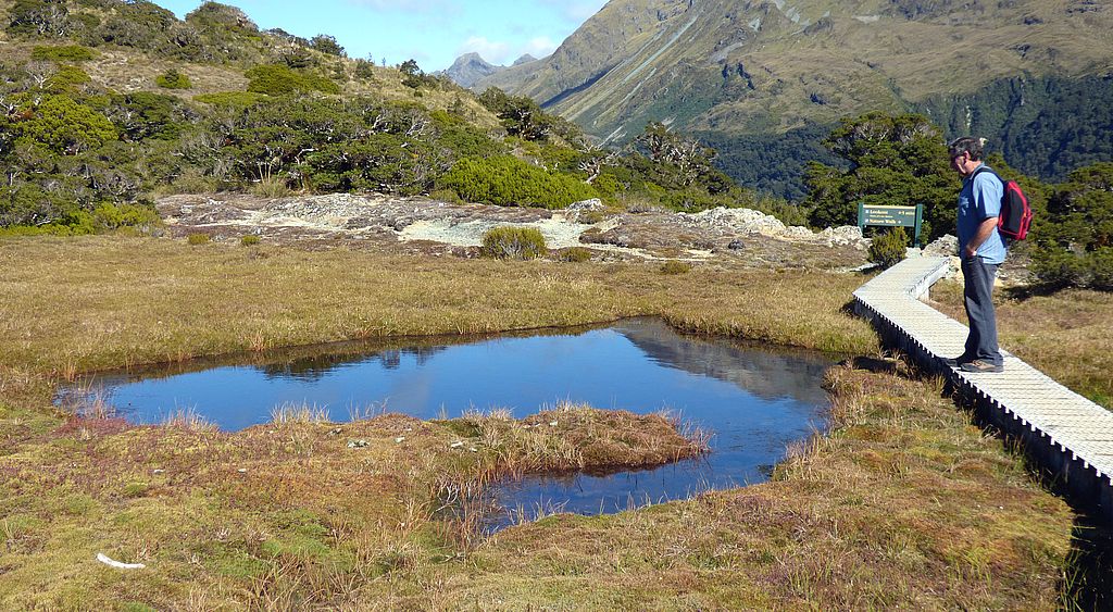
Next morning we woke up to a cloudless sunny day so it was a great opportunity to go back to do the walk up to Key Summit. Back up past Lake Gunn again (looking spendid in the sun). Pulled into The Divide carpark at the start of the Routeburn Track and where the Key Summit walk also starts.
Lake Gunn when sun is out
We followed the Routeburn Track for about 45mins and then branched off towards the summit. It was a steady ‘slog’ uphill all the way and even steeper once we left the tree line towards the top. Thankfully the last bit was a zig-zag path rather than steps which I always find tougher on my legs.
View over the Hollyford Valley
What an amazing 360° view from the top at 918m (which we worked out was a 400m climb up from the carpark). The huff & puff to get there was well worth it!
View of the Humboldt MountainsThe Darren MountainsGlacier Ice
Little glaciers on the sides of the Darren Mountains and down in a hanging valley was Lake Marion. There is a track up to it from the Hollyford Road but we’d been told it is a very hard walk so we weren’t planning to attempt it…but at least we can say we’ve ‘seen’ it.
Hanging Valley & Lake MarionLake MarionMountain signboard
There was a 30 min Nature Walk at the top of Key Summit to view little tarns and boggy patches, deep spongy mosses, low growing alpine plants, stunted bushes, tussock and tortured looking beech trees heavily ‘carpeted’ in mosses (thought to be around 400-500 years old). The only sign of life we saw were a few hardy looking brown grasshoppers but apparently birds do venture here.
Nature Walk TarnBog growthAlpine lifeAncient Beech Trees & view towards Eglington ValleyMossy treesAlpine plant lifeEarl Mountains & Pyramid Peak
We spent some time at the top just gazing at the views towards the Humboldt and Darren Mountains and down into the Hollyford, Greenstone and Eglington Valleys. It was quite overwhelming – on such a perfect day it was hard to imagine being here on a snowy, windy winters day. The best photo right on Key Summit that sums it all up was just a perfect ‘postcard’.
Key Summit tarn & mountain views
After spending over an hour at the top we reluctantly returned to the track and in no time it all, it seemed, we were back at the carpark. The sign says 3 hours return and all up it took us around 3½ hours including all the time we spent at the top, so we felt pretty proud of ourselves.
We drove back along the Milford Road and ended up back at the Totara DOC camp again for the night.
We arrived back at Te Anau the next day and spent another 3 nights at the Club Park.
Marina – Te Anau
Visited the local DOC Wildlife Refuge and saw a couple of Takahe wandering around their enclosures. A volunteer told us there were chicks this year but a local falcon got them! They are now planning to put a covering over the area – now that doesn’t sound like rocket science!!
TakaheTakahe – DOC rescue centre
Lake Te Anau Outlet Gates
Also drove to the lake outlet gates – amazing forces of swirling waters – you’d be drowned there for sure if you fell in.
Wild water currentsNo Swimming – that’s for sure
Done our time in this area – moving on tomorrow (08 April).
08 April – back on the road and heading to the Mavora Lakes – the turnoff approx 35 km east of Te Anau. Then about 40 km of gravel road up the Mararoa River Valley and into the DOC Conservation Area. There are two lakes and a number of camping areas are sited along the lakesides. Stopped at the lower lake for a quick look around – lovely views.
Lower Mavora Lake viewSwingbridge over lake outletView up Lower Mavora Lake
We then drove on to the North Lake and found a great spot looking up the lake – the camps here are more open and less sandflies as a consequence.
Upper Mavora Lake viewUpper Mavora Lake & mountains
We spent 3 days in the area relaxing and enjoying the scenery. We walked part of the track which circumnavigates the Lower Lake. It’s a 2½ hr loop but as we set off a bit late in the day we just went part way and then retraced our steps back to camp.
It was a great walk – firstly crossed a swingbridge over the outlet from the North Lake, followed the river to the South Lake, across some tussock land and then back into the forest along the South Lakeshore. We turned around when we came across a real boggy bit (has been a fair bit of rain in the area of late).
Upper Mavora Lake Outlet & start of walkwayLake outletForest WalkwayNorthern end of Lower lakeFriendly Robin
There are two Lord of the Rings sites at Mavora – the Silverlode River and the Fangorn Forest. We didn’t see any Orcs, Goblins or Demons, but you sure could image them skulking around in the trees.
Forest walk around lake
The 3-4 day Greenstone Walkway also passes through Mavora – it starts past Glenorchy on the western side of Lake Whakatipu. This is also forms part of the Te Araroa Trail which will eventually cover 3,000 kms from North Cape to Bluff. The Southern Horse Trail also uses this path and there is even a horse holding paddock at the DOC camp for riders passing through and resting up here.
Unusual toadstools at campToadstoolTarn at road entrance
We eventually headed out – stopping to look at a pretty tarn and bog area at the lake road intersection.
We thought about turning left here; up the Mt Nicholas Road which takes you through to Walter Peak Station (where the “Earnslaw” boat trip from Queenstown goes to). But we’ll possibly do that trip across Lake Whakatipu at some later stage. So onward through Mossburn to end up at the Club Park in Lumsden for the night.
Next day we continued eastward to Riversdale where we stopped to have a look in the ‘renowned’ antique/curio shop there. It was closed the last time we drove past. Quite an Aladdins cave…the usual 2nd hand paraphenalia but they also had a great selection of semi-precious stones and rocks, old coins, stamps and first day covers, books, old bottles and so on. We ended up spending more time there than we intended as it was so interesting.
The Bottle House at Waikaia
From there we headed up another side road to Waikaia where the ‘famed’ Bottle House is. Stopped to take a look, it was all fenced off as it looks like they are upgrading the next door Museum area – took a photo and moved on.
Bottle detail
Destination was the DOC camp at Piano Flat Domain. The road followed the Waikaia River which was brown and flooded after the recent rains.
The grass camping areas were very waterlogged so we parked up on a gravel carpark, so we wouldn’t get stuck or rip up the ‘lawns’ with our wheels.
This is a real pretty area and was well worth the long drive in – the Domain/picnic areas, the river and thickly covered bush on one side; forest and hills on the other with several privately owned ‘Cribs’ dotted on the high ground around the camp.
Water flooded 2 days before
The weather was good the next day so we set off to do the Riverside Walk upstream. However, the track was not in good condition and so boggy in places we were having to bush bash to try and get around them. After about 20 mins ‘we called it a day’ as we hadn’t even got past the picnic area and at that rate it was going to take us a lot longer to do the complete 4 hour loop walk.
Swingbridge Start of the River WalkPiano Flat Domain from River TrackRobin listening for food
So back across the swingbridge and we walked up the camp to the start of The Piano Flat loop walk up the hills on the opposite side of the area.
This track goes up behind the Cribs and follows an old gold mining water race for a while before crossing a creek and meandering back down on the other side of the creek. The water race is still maintained as the water supply for the Cribs and camp area.
Water race from gold sluicing days – now acts as water supply for cribs & camp area
The last bit was quite a steep downhill section back to the road. We were interested to see recent hoof prints and long skids marks on the path that looked like a stag had charged headlong down here quite recently. It’s currently ‘the roar’ season and earlier we were overtaken on the track by two hunters that were heading further up to the hilltops. The stag that was in this part of the bush was very wise, as being a public walkway, it’s a ‘no shooting’ zone.
Native Falcon – resident of Piano Flat – just watch your heads during nesting season
A short walk back along the road and we were back at the Domain area – where we encountered the ‘resident’ native Falcon that we had been warned about. It was sitting on a fencepost about a metre away from us before we spotted it but by the time I got the camera out it had flown to a nearby tree. It nests in the area and has the habit of swooping down on people with talons ‘bared’. But today it was ‘just looking’ and didn’t bother us.
Next afternoon we set off on another walk – this time following the roadway up the valley alongside the river on the eastern side. This road turns into a rough 4WD track that continues up and over the Old Man Range and comes out north of Roxburgh.
Wakaia River from road
We walked as far as a Walking Track leading to the Titan Rocks and then U-turned back to camp. We had intended to go to the northern swingbridge (that we didn’t get see from The River Walk the day before), but the road left the river here and it would have meant another wet slog along the riverbank to get there.
River – Piano FlatAlmost back at Piano Flat
Chatted to a local crib owner on the way back to the motorhome who told us that the river tracks are in bad repair and take a lot longer to walk than indicated. Recently an elderly person had to be ‘rescued’ after becoming exhausted trying to walk it. Glad we didn’t get ourselves in that position.
Next morning two hunters, that had parked their car beside us for 2 nights, arrived back – what no deer?? Where are our venison steaks?? They had been hunting around the Titan Rocks and on their first night while sitting at their camp a stag rushed out of the bush to look at them…they scrambled to take a shot…but they didn’t get it (read that as ‘missed’).
Our last morning here was just magic – the flood had quickly subsided over the last two days and the river was a lot clearer – though it is apparently usually ‘tea’ stained.
Hopeful AnglerWaikaia River – flooding went down very quicklyDownstream from swingbridge – tea stained water
We eventually headed out, back to Riversdale and made a beeline for Gore. Returned to the A&P Showgrounds for another couple of nights.
The Big Trout
Before moving on (17th April), I went and had a browse through the Hokonui Moonshine Museum. It was quite interesting following the times of Prohibition and the ways the illegal stills were hidden from the Police and how people ‘got around’ the laws. Like catching ‘taxis’ to Pubs outside the “dry” area to have their ‘fill’ and sneaking the grog back into the area over the hills. I had my ‘shot’ of Old Hokonui Whiskey at the end of the tour – not that I’m keen on whiskey but hey…it was included in the price…so wasn’t going to waste it!
The Big Trout was located in the same area so had to take the obligatory photo.
Drove north on SH90 and got as far as Tapanui and decided to stop the night there. The Club has a spot organised in the town for members but we settled on staying at the Whiskey Creek Domain instead. A little walkway up Whiskey Gully starts from there and we had a look at it in the morning. Followed a rocky stream in a loop for 15 mins. Another track branched off uphill steeply to a waterfall and a 5-6hr track along the ridgetop (another day!).
Nature walk
Still heading north we turned east at Raes Junction and along SH8 towards Lawrence. Parked in town and walked the main street looking at the historic buildings, they had plaques on them telling the history of each one. It was quite well done and saved having to carry a brochure around with you to follow the trail. Then drove into Gabriels Gully gold mining area and to Greys Dam for a lunchstop.
Greys Dam – Gabriels Gully
Moved back to start the Walkway around Blue Spur that skirts the flattened ‘gully’ below and follows the old water race networks around Polland’s Hill. Good interpretive panels to explain everything along the way (though some have not ‘weathered’ well). The longest water race for the Blue Spur Sluices was directed from the Waipori River over rugged country for 64km – an amazing feat to keep it level in those days with basic levelling devices. The water was stored in a series of dams and then directed down the hill to the sluices as needed. (By 1865 there were 872 km of water races supplying the Tuapeka Goldfields areas).
Gold Mining ValleyGabriels Gully – pond is where the Hydraulic Elevator was locatedGabriels Gully – sluicing area
Walked downhill again past lovely autumn colourings on the hillside, to the site and relics of “The North of Ireland” battery stamper.
Autumn colouringSite and relics of Stamper Batter
Path then went uphill again around the other side of the gully to view an old mine shaft and descend down “Jacobs Ladder” where the Gold Office was situated.
Entrance to The Great Extended Mine
It was all very interesting – gold was discovered in Gabriels Gully by Gabriel Read in May 1861 and by September there were 6,000 men working the gold field. When the easily mined gold was exhausted the methods changed to sluicing which required large amounts of water so ‘miles’ of water races were constructed to wash the spoil and later stamper batteries were used to crush the quartz to extract the gold.
The Blue Spur at the end of the gully was once a ridge but it was blown apart with explosives and finished off with the introduction of hydraulic elevating (gravels were sucked up a vertical pipe by pressurised water from a bottom uptake pipe – the water and gravel was forced 20m upward and over gold collection sluices). The Spur was basically flattened by the 1930’s and the spoil raised the floor of the gully by 50m).
Blue SpurGabriels Gully mining signboard
We drove back to Greys Dam after our trek to stay overnight there. It was such a neat place and an ever changing picture.
Greys Dam – late afternoonEarly morning – Grays DamMorning reflections
Set out to do some more exploring the next day. Looked at the nearby Victoria Dam (Milburns Pond) which is a public picnic area and the start of a 2hr walking track up Munro’s Gully. Reflections on the pond were quite pretty but these ponds are not very clean looking as they are old storage ponds from mining days and don’t have much of a water flow through them.
Milburns Pond
Visited the old ‘ghost town’ of Blue Spur – not much to see, just an Info Board and a couple of old houses (currently occupied, so we didn’t like to be too nosey). But it was quite a nice view back towards Lawrence from the top of the hill.
Lawrence townshipStamper Battery signboard
Once in town we checked out a heritage display of mining relics and a restored Battery Stamper and went for a 20min walk through the forest on the hill opposite the town. That was just a stretch of the legs as there wasn’t much to see.
I also had a browse in the local Museum which also doubles as the Info Centre.
Mining scene
Stamper BatteryHeritage buildings – LawrenceHistoric hotel sign
Next – up the main road for 1km to the Chinese Camp area. More Info Panels but the only structure left was an old shed and the old Historic Chinese Empire Hotel. It was owned by a Chinese man who married a Scots woman and the Establishment was reputed to be one of the best wayside hotels in Otago in those times.
Old shed chinese campHistoric hotel – Lawrence Chinese CampWeatherstons Signboard
Where next – a bit further out of town to Weatherstons another gold strike area. We went to have a look at the ruins of the Black Horse Brewery and was the area’s most successful business – first established in 1866 and brewed award winning beer – coveted throughout the goldfields and from Bluff to Canterbury. NZ Breweries purchased the brewing rights in 1923 and the brewery closed. If you click on the photo of the signboard it makes quite interesting reading. At some stage it was developed as a picnic and walking area but that has all fallen into disrepair too.
Black Horse Brewery signs
We arrived at the end of the road and chatted to a couple who have a little property there and they told us the place is closed and fenced off, but they said if we wanted to go and have a look still, there would be no-one to stop us. So with a bit of a ‘careful’ scramble over an electric fence we got in for a look around.
We found it all quite interesting – old overgrown tracks to a waterfalls and picnic areas, an enclosure that used to be a tea rooms, a plant nursery. It’s a shame to see such ‘history’ of the brewery building just falling further into decay. As it’s still privately owned it will eventually just disappear into the undergrowth.
On the way back to our ‘camp’ at Greys Dam, we stopped to look at the Miners Monument on the way to Gabriels Gully.
First gold strike monument
Frosty morning
Woke up to a frost on the ground in the morning – moving off today so did a bit of a walk around to the other end to look back over our ‘perfect campsite’.
Greys Dam again and our campsiteGabriels Gully history
One more walkway we wanted to do before we left Lawrence. Stopped again at Gabriels Gully carpark to walk around the valley floor area.
Towering rocks around the edges to make you feel small! Had a closer look at the Pond that we’d seen from the walkway around the perimeter.
A piece of hill that has survived the sluicing – wonder if there’s a big gold nugget insidePond in Gabriels Gully where the hydraulic elevator stood
Leaving the area today (20 April) – reckon we’ve had a pretty good look around here….time to see what’s around the next corner
20 April – left Lawrence and headed south-west from town over the hills to Tuapeka Mouth.
Going to have a look at the historic ‘punt’ across the Clutha River. Prior to bridges across the river there were a number of punts operating and this is the last one that is still in service. Sign says it’s funded by the local Council, but these days it is actually part of the National Roads system and it is free to foot and vehicular traffic. We stopped to have a look and check out the hours of operation: 8-10am and 4-6pm daily.
Tuapeka PuntDrive on ramp
There’s a good place to stay in Tuapeka Mouth – just $5 to park up at the old Presbyterian Church which is now cared for by the local Heritage Hub. Both the church and clubrooms on the grounds are open and a sign says we can use as much water as we want. Inside the clubrooms there are books, magazines, games and puzzles free for the taking and a ‘fully-fledged’ kitchen and lounge area to use. We actually stayed there two nights it was so ‘welcoming’ and it rained all the next day so we had a ‘day off’.
When we moved off we got ourselves organised early enough to get down to the Punt during operating hours. We knew we wouldn’t be able to take our motorhome across because the overhang from the rear wheels is to long – the weight of the truck as it drove on would make the angle of the ramp too steep and the rear would bottom out. But we wanted to be around to see someone else take the journey across.
As soon as we parked the punt operator came out of his little hut to welcome us and said no problem to take us for a ride across and back. Cool! The operator told us that he actually works for Downers who have the contract from NZTA to run and maintain the Punt.
We were fascinated to learn that the punt is propelled across the river by water power alone. Once it is untied, the rudders on the two pontoons are angled so that the fast river flow catches them and it drives it across the river. It is prevented from racing off downstream by cables that run across the river and hold it ‘on course’. Once we hit the main current of the river we were really racing! To come back – the rudders are just angled the opposite way again. All very natty! Just as we got back to ‘our’ side of the river someone appeared over the other side so the puntsman was off again to give them a ‘joy’ ride too.
On our way across – cable attachment so we don’t float downstreamPuntsman taking it back across to pick someone upPunt on the far riverbank
The Clutha River is fast and deep and in the early days the punts were the only practical way to cross over. The water flow is actually quite awesome – if you ended up in the water you would be ‘miles’ downstream before you managed to get yourself to the other side.
But on looking at the map and see where it comes from it’s no wonder – both Lake Wanaka and Lake Hawea feed into it and become the north part of Lake Dunstan. At Cromwell, Lake Whakatipu also feeds into Lake Dunstan via the Kawerau River and it all gets banked up by the Clyde Dam north of Alexandra. From there it becomes Lake Roxburgh behind the Roxburgh Dam before running ‘free’ again. The river is the longest one in the South Island and the second longest in NZ. But it’s the largest river in NZ by ‘volume’ and it’s average discharge into the ocean is estimated at 614 cubic metres per second – it’s also listed as one of the world’s most swiftly flowing rivers alongside Australia’s Macleay & Fitzroy Rivers and the Amazon and Atrato Rivers in South America. What makes it unique is the relative short distance it travels in comparison to these other ‘mighty’ rivers.
Leaving there we had to drive south to cross over the river bridge at Clydesville and then drive up the opposite side of the river to get back to Beaumont on SH8 so we could carry on towards Roxburgh.
But before then we decided to do a longish side trip to go and see remote Lake Onslow which is high in the hills north-east of Millers Flat. Gravel road again – bugger – we had just used the free water back at Tuapeka Mouth to give the truck it’s first clean for months….after 40 mins of driving it was covered in dust again!
But it was worth the drive – the last part of the journey is a narrow dry weather clay road so not an area we would be able to drive the truck to for most of the year.
The road climbed up towards Mt Teviot (997 metres) and the view over the rolling hills and valleys was impressive.
Driving to Lake Onslow – near highest part of road 936 metres
We passed a forestry plantation and nearer the end there were large cattle ‘beasts’ grazing and giving us the evil eye! Eventually we got a view of the lake which covers quite a large area of the valley before us and formed by damming the Teviot River in 1888 and flooding an area called Dismal Swamp. It’s 710 metres above sea level and was originally created for gold mining and irrigation purposes.
Approaching Lake Onslow
As we got closer we got to see the remote Huts built along the shore – as the lake is full of brown trout it is a popular spot for keen anglers and we learnt that some of the cribs are owned by fishing clubs.
Lake Onslow camp areaHuts along the shore
The only sign of life was a boat trailer at the boat ramp and we later saw the boat arriving back and the vehicle driving off down the road.
We stopped for lunch and wandered around afterwards looking at the huts and their associated long drop sheds – some were pretty ramshackle, others a bit more ‘grand’ but for sure they all shared an amazing view across the lake.
Parked at Lake Onslow
While walking around we noticed some black clouds starting to get nearer to the area and also felt a few raindrops – so we made the decision not to camp there overnight and head back out. The forecast was also not very good so we didn’t want to risk the clay road turning to mud and the truck getting bogged.
Lake waters banked up near Dam wallLake Onslow from Dam area
On the road out – thankfully the rain haven’t made any changes to the road yet so no problems getting back to civilisation!
Rolling Landscape
Arrived back at Millers Flat Store and bought a huge cone ice-cream for only $3 – best value for a long, long time! Then headed north along the back road to Roxburgh to arrive at Pinders Pond free camp area for the night.
Pinders Pond late afternoon reflectionPinders Pond historyPinders Pond early morning
Pinders Pond is actually the site of an old 1918 Gold Claim where a big hole was dug to a depth of 23 metres to search the old riverbed in the hope of finding a seam of alluvial gold – unfortunately nothing was found and it was abandoned in 1922.
The hole has filled with water and is now a popular swimming and recreation area. People also throw lines in here, so presumably there are fish to be caught too.
The Clutha River runs alongside one side of the Domain and the Clutha Gold Cycle Trail also passes through it. It’s a popular part of the Cycle Trail judging by the numbers of cyclists we saw ‘peddling’ past.
Clutha RiverFishing at Pinders Pond
Next morning we drove up the road and over the bridge into Roxburgh. The town was buzzing with people everywhere….a Film Crew has taken over the town for a few days – filming the latest version of “Goodbye Pork Pie”. Road closures, people running around with radios, trolleys carrying all sorts of equipment: make-up gear, lights, cameras, batteries and goodness knows what!
We did our grocery shopping and escaped to go south again to the start of a walkway to an historic Suspension Bridge over the Clutha River. Weather was not very nice but we donned rain jackets and set off anyway.
The 1½ hr walk took us through private farmland to a part of the river called Horseshoe Bend, also the a site of an old gold mining community. The gold workings, School, Post Office and other amenities were all on the other side of the river and people used to cross over here by small boat or by a chair attached to a wire that they used to pull themselves over on, 75 metres above the water. Nothing left of the community to see but the Suspension Bridge that was built in 1913 has been restored and is a popular walk.
Bridge over the Clutha River at Horseshoe BendBridge crossingClutha River flowing swiftly past under our feetHistory of the river crossing
On the other side we had intended to extend our walk to go and visit the “Lonely Graves” site, but our map was not very clear on how long it would take us. By this time we were pretty much soaking wet and cold so we decided to give it a miss and just head back to the warmth of the van.
Historic Bridge at Horseshoe BendHorseshoe Bend south of the bridge
Stayed at Pinders Pond again that night and next day we went back into Roxburgh to tackle the Grovers Hill Walkway. We climbed quite steeply uphill and out onto an outcrop of rocks to “Frog Rock”. Not that we could see anything that resembled a frog but it was a lovely elevated view over the township and the Teviot Valley.
View over Roxburgh from Frog RockWalkway views
The path then meandered gently down through a pine plantation and took us back to the river and an old gravesite among the trees.
Miners Grave – but no information on who the miner wasA rock for a headstone and a few stones marking the spot
The loop back undulated along above the riverbank with nice viewpoints along the way.
View over Clutha River from high point on walkwaySouth Island ‘Black’ Fantail posing for us
It was a great walk that we really enjoyed.
Listed time to walk it was 1½ hrs but it actually took us a lot longer than that as we lingered along the way to explore and really enjoy the views.
Roadway across the river to Pinders Pond and the Goldfields Cycle Trail beside itRock face along walkway – ‘Frog Rock’ up there somewhere
Drove to the town which was all very quiet as the film crew were having a rest day. We drove along the riverbank park in town and read the sign telling the story of the town’s three river bridges. Then drove around to have a look at them (or what is left of two of them).
Roxburgh’s Bridges
The first bridge was built low on the riverbank and was destroyed by wreckage of the Clyde River Bridge upstream, that was washed away by flood waters in 1878. Further downstream the wreckage then demolished the Beaumont and Balclutha Road Bridges…awesome!!!
Clutha River at Roxburgh & 1st Bridge foundationPiers of 2nd Bridge (1887-1974) alongside today’s BridgeRoxburgh Bridge today (3rd one)View from town bridge towards the Roxburgh Gorge
Back to Pinders Pond again, after parking and settling in we decided to try and walk around the Pond. The track on the road side is quite elevated and gave us some more great views over the area. Track ran out but with a bit of scrambling we managed to get right around.
Pinders Pond viewpointSignboard giving more history on the areaWalking around Pinders Pond
25 April (Anzac Day) – decided to spend another day in the Roxburgh area so we ‘upped sticks’ and drove up to have a look at the Roxburgh Dam. Stopped near the Spillway Outlets and watched some people fishing from the sheer concrete wall at the edge – I wondered how they were going to retrieve any fish they caught then saw a couple of ‘net frames’ with wheels on one side and a rope attached so it can be rolled down the wall into the water below to place under any hooked fish and then haul them up to the top. Would have loved to see this happen, but the fish weren’t biting!
Roxburgh Dam and spillway outletsLooking across at the ‘fishing wall’
Then drove up to a Lookout that gave us a great view over the whole dam complex and the valley below.
Behind the dam – Lake RoxburghAcross the DamInformation signLots of ‘electricity’ and looking down the Teviot Valley
Then over the top of the Dam to a picnic area for lunch and afterwards went on a 30 min walk up to another Lookout from another angle.
Dam from Spillway LookoutSignboardViewpoint rock
Then went back to Pinders Pond for a final night…later in the afternoon we were treated to an amazing cloud formation.
Cloud formation over Pinders PondMiners Monument
26 April – Left Roxburgh and headed north towards Alexandra.
Made a couple of stops – one to check out a Monument dedicated to the Pioneer Miners who perished in “The Great Snow of 1863” and then Butchers Dam about 9km south of Alexandra.
Free camping allowed here but we’ll come back and spend some time here later. Water level obviously well down at the moment.
Butchers DamButchers Dam 2Dam wall
Arrived in Alexandra – parked near the main shops alongside the river – after the starkness of Butchers Dam, it was a riot of colour.
View down the river at Alexandra
Alongside the main Alexandra Bridge are the foundations of the old bridge that was obsolete when the Roxburgh Dam was built and raised the water level – the rest of the bridge supports are now underwater.
Old bridge foundations – AlexandraAmazing stonework – at lot of it now underwaterUnder the bridge
Spent the next couple of nights at a large free parking area for NZMCA Members on Council land adjacent to the Alexandra Aquatic Centre. It was very convenient and being well used by other club members.
We were considering doing the Clutha River Cruise and when others told us it was well worth the cost we got on the phone next the morning and they said “we’re going this afternoon and still have space” so as this was the last cruise for the season, we timed it just right.
We took heaps of photos on the trip so have created a separate ‘blog’ to cover the journey. We were glad we went – we learnt heaps about the history of the mining of the river before it was flooded and as we cruised along the Operator was able to point out all the little rock shelters on the hillsides where the miners lived. Most were so well hidden that unless you knew where they were, you would have missed them altogether. The Gold Trail Cycle Track runs along on one side of the river but the main mining area at Doctors Point is on the opposite side, so you can only get to it by boat. We pulled ashore at Doctors Point and had lots of time to roam around the main mining area before we cruised slowly back to Alexandra. The river journey itself was neat, the water so calm and the trees lining the banks all lovely in their autumn colourings.
Clutha River CruisingClockface (and it keeps good time)
28 April – Laundry day so I spent most of the morning at the Laundrette while Neville went off to do the shopping and fill with fresh water.
After that we went to have a look at a couple of sights in the town. High on a cliff face is an 11 metre wide clock that can be seen all over town – it was built there in 1968.
A walkway to the clock crosses over the historic ‘Shaky Bridge’ that spans the Manuherikia River that runs into the Clutha River a short distance downstream. We went for a walk over the bridge – it used to take vehicles but fell into disrepair and then restored as a foot bridge only. There wasn’t much water in the river below but it is apparently a popular swimming hole in summer.
The Shaky BridgeManuherikia RiverSwimming Hole
Lingered chatting to a couple who live in a house at the road end. They told us that the river is slow and not really flowing because it is banked up against the fast flowing Clutha River which is at high level at the moment too. The couple have a neat house that is built on and around huge rocks above the river. We finally headed off – back to Butchers Dam for the night and where we could put our clothes outside to dry.
Laundry Day
Not long after a little 4WD car pulled up beside us and it turned out to be the couple we were talking to in Alexandra. Lyn and Merv called to ask if we’d like to accompany them on a drive up to the Obelisk – what a fantastic surprise. The Obelisk is a natural schist rock Tor that stands 26.6 metres high on the ridgeline of The Old Man Range that overlooks Alexandra from the south. The shortest road to it is a 4WD road that branches off SH8 near Fruitlands. We had already heard of this landmark and whilst 2WD vehicles have made the journey OK in dry weather, we didn’t think the narrow and steep road would be a good place to try taking our truck up. So we had already resigned ourselves that this was one place we wouldn’t be seeing in our travels.
Needless to say we were absolutely ‘stoked’ to be invited along on the trip. Merv said that despite living in Alexandra they had never driven up there either and seeing as it was such a perfect day it was a good time to go.
The first part of the road was a normal gravel road then went through a gate and encountered a grader that has been working on the next section to the top of the ridge. This was possibly bad luck because the grader had not finished his work and had stirred up lots of loose rocks that had to be dodged and made it more difficult. The road kept going up and up and we passed several huge impressive rock outcrops along the way. There were definite lines too where the vegetation changed as the altitude increased. On reaching the treeless ridge we turned right and travelled another 2.5 kms along the top towards the Communications Tower.
We got out of the car on arrival at the Obelisk and were blasted by a freezing cold wind, the sun was still shining but no warmth to be had from it. The average annual temp here is 0°C. But then that was not surprising as we were 1695 metres above sea level.
The 360° view was just amazing – Alexandra far below looked as big as a postage stamp, Butchers Dam tiny – had to zoom in the camera a long way to see them properly. It was a bit hazy being late afternoon but apparently on a clear day Stewart Island can be seen to the south, Mt Cook to the north and Mt Aspiring in the east. There were actually two monolithic rocks by the tower and we were not sure which one was the actual Obelisk so took photos of both. Later checked and the first photo is the correct one.
The ObeliskThe Obelisk & friendView over AlexandraAlexandra townshipCommunications Tower & building and TorsView to the westView over Butchers DamButchers Dam
As an interesting ‘aside’ this 4WD road continues along the Old Man Range and descends on the other side down to Piano Flat (where we camped just over 2 weeks ago) and is the same road where the 36 people had to be rescued when their vehicles became stuck and snowbound on 23 May (3½ weeks after our visit to the Obelisk). Same day we were in Cromwell, it was freezing cold and the forecast was predicting snow to low levels so we decided to have a ‘rest’ day. Heard on local radio that the river through Piano Flat was flooding nearly 2 metres above normal levels and we‘d made the comment that the road and camping area through there would be under water. (So even if the 4WD trip had got that far they wouldn’t have been able to get through there either).
Anyway after our photo stop we headed down the hill again and near the bottom we stopped to visit the historic Mitchells Cottage completed in 1904. The stone cottage was built over a 20 year period by two Scottish brothers who came in search of gold but ended up mining and farming in the area. It housed one couple and 10 children…it must have been a tight fit.
Mitchells CottageCottage & rear utility buildings
We were dropped off at Butchers Dam just before dark…a trip we won’t forget for sure. We were really ‘blown away’ by the hospitality of Lyn and Merv and their invitation to share the trip with them.
Next morning we made a snap decision to head to Wanaka to pick up a courier parcel that was being sent to us from a Dunedin company providing Rural Broadband on a ‘roving’ basis that we have recently heard about. We have been buying 10GB for $120 from Skinny and always running out and having to top-up through the month which was pretty costly but the only practical option as the Vodophone & Spark Rural Broaband services are locked in to one celltower. This new service is going to cost us $95.95/month for 80GB/peak plus 50GB/offpeak – so we will never run out now. The service connects via the Vodafone towers but is fully roving so we can move about without having to be dedicated to a singe tower. Magic! We have been using it now for over a month and have been able to get our Internet everywhere we’ve been so far. There will be places where Vodafone is not available, but then we can fall back on our Skinny Data which has a 6 month ‘life’ and we can just do a lower‘$‘ top-up on that when needed to keep it ticking over.
Drove off towards Clyde and stopped at the Lookouts overlooking the town and the Dam.
Clyde town viewClyde Dam & Lake DunstanClyde DamClyde Dam signboard
From there it was a lovely scenic drive alongside Lake Dunstan towards Cromwell. Stopped at a couple of Lookouts along the way.
Lake Dunstan back towards ClydeSteep barren country on other side of the gorgeView towards Cromwell & The Junction (Kawerau & Clutha Rivers)The Big Fruit (halfway through getting a repaint)
Travelled up the western side of Lake Dunstan on the way to Wanaka, where we drove along the waterfront and reminisced about the last time we were here (Jan 1994), when the lake was flooding right over the road and up into the shops. Seems it’s a fairly common event when I look at the records on ‘Mr Google’.
We went to check if the courier had delivered our ‘Modem’ yet and it was there waiting for us. So then had to find a place to stop for the night – settled on the carpark at the Albert Town Tavern (just north of Wanaka) – a few caravans there also. We just had to sign in at the Bar and all good. Later we indulged in a nice meal in their dining area – was good having a night off from cooking duties.
Next morning we did a bit of ‘tiki touring’ before we headed out – firstly going to see the Hawea River. Found a nice walkway over a bridge and stretched our legs – the river is very fast flowing and amazingly crystal clear. The water level was quite high and trees on little islands in the riverbed were getting wet feet. Nearby the Hawea River meets up with the outlet water from Lake Wanaka and at that point it becomes the ‘mighty’ Clutha River that we have been following in our travels of late.
Walkway over Hawea RiverCrystal clear water
We then drove back through town via the scenic route around Lake Wanaka.
Lake Wanaka – outlet to the right of photoLake Wanaka township & Marina
Going to head back to Cromwell for the night – this time we drove back on the eastern side of Lake Dunstan. Stopped a couple of times along the way to look at some free camp areas but in the end we went across the bridge past Cromwell to stay again at Lowburn Harbour on the lakeshore – ‘our spot’ was even empty and waiting for us.
Alexandra – going on the Clutha River Cruise today departing at 1:00pm.
We were at the Boat Ramp early and watched the boat being launched ready for the trip. It was lucky that we phoned to book the night before as this was the last sailing for the end of the season.
Our River Cruise craft
We cast off on time, together with two other couples, Laurence our guide/skipper and his teenage daughter who had come along for the ride too.
Setting off on our River Cruise
We headed off past the old stone bridge pylons and cruised slowly downstream taking in the sights – the water so calm and a beautiful greeny/blue colour and the trees lining the banks all lovely in their autumn colourings, making a sharp contrast to the stark grey rocky hillsides.
Cruising towards the Roxburgh Gorge
Laurence was very knowledgeable and we learnt heaps about the mining of the river before it was flooded and the lives of hardship the early miners endured. As we cruised along he pointed out the little rock shelters on the hillsides where the miners lived. Most were so well hidden that unless you knew they were there, you would’ve missed them altogether.
Chinese Miners Shelter
Three more rock sheltersWould you like to live here through freezing winters
The steep rocky walls lining the sides of the gorge were quite awesome – reaching nearly 350m on both sides at one point. There is an old walking trail starting from Alexandra (near the Shaky Bridge) that goes to the mine area at Doctors Point – at times we could see it near the riverbank and other times high on the hillside. In the early days miners would have to trek along this to reach a settlement where they could buy supplies.
Rough countryDog RockRoxburgh Gorge
The Roxburgh Gorge Cycle Trail runs alongside the other side of the river. It stops, however, opposite the Doctors Point mining area. The cyclists then have to travel by boat downstream for 12kms to rejoin the southern section of the Trail. Apparently the Landowner of this middle section has not yet given permission for the Trail to be developed on this part. Perhaps he’s in cahoots with the local boat operators..the fee for an adult with bike is $95!!!!
Cycle Trail running alongside river
We pulled ashore at Doctors Point and had lots of time to roam around the main mining areas.
Approaching Doctors Point
This area has some pretty intact house ruins and shelters, large areas of mine tailings, old tunnels, water race channels and sluicing pipes lying around. It was all very interesting.
As we walked around we were walking on and disturbing wild thyme plants which were giving off their beautiful fragrant aroma. The plants were introduced by the Chinese Miners to add flavour to their cooking – they have thrived in the bleak growing conditions and now cover vast areas in the Central Otago goldfields. They must look amazing when they flower in summer.
Ruins on the hill – Doctors Point mine areaRuins and tailingsTailingsOld dwellingWindow viewHouse ruinsOld water raceOld sluice pipesMine entrancesMine entrancePeering inside a mine
Exploring around the ruins
Ruins at Doctors Point
Once we had all finished our exploring we enjoyed a hot drink and muffins on the riverbank before we boarded the boat for the return journey.
Tea TimeBoat at Doctors PointLeaving Doctors Point
There were more dwellings to see hidden among the rocks on our way back up the gorge.
Old Mining shelter on hillsideShelterWhat if there was a big earthquakeRocks along the river
At Butchers Point we could see a larger ruin of the Leaky Lodge Hotel, that probably profited well from the miners spending their earnings on the way back from cashing in their hard earned gold findings.
Ruins of old Hotel
We really enjoyed the trip and felt it was money well spent. The Doctors Point area can only be reached by boat (unless you wanted to swim or face a very long 20km return walk from Alexandra) so it was a place that we would not have seen without going on the Cruise. The trip down the river and along the gorge was a serene and the colours and scenery well worth seeing…I would do it all again!